
(Last updated: Sep 2026)
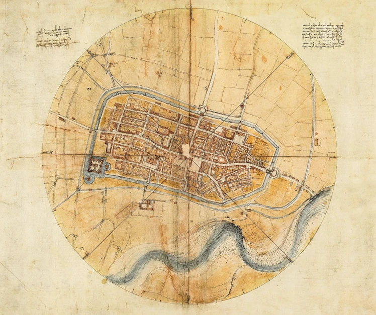
Leonardo da Vinci maps are among the strangest and most beautiful documents to survive the Renaissance. They look like satellite images sketched centuries before satellites existed, showing entire towns as if seen from a bird circling directly overhead.
Long before modern surveying equipment, Leonardo combined art, mathematics, and military thinking to capture cities with startling accuracy. His maps weren't decorative sketches.
They were working documents, made to help rulers defend towns, plan roads, and understand terrain in ways almost no one else could visualize at the time. That mix of precision and imagination is exactly why his cartography still fascinates historians, engineers, and travelers today.
Most people think of Leonardo as a painter first, an inventor second, and everything else as a footnote. His maps complicate that picture in the best way. They show a mind that treated an entire landscape the way he treated a face or a machine: something to be studied, measured, and understood from every angle before a single line was drawn.
Once you understand how these maps were made, you start noticing Renaissance cities differently. The walls, rivers, and street patterns Leonardo once measured by hand are still there, waiting to be walked.
This post is all about Leonardo da Vinci maps, the Royal Collection at Windsor Castle that preserves them, and where you can still encounter this remarkable cartography today.
What are Leonardo da Vinci maps?
Leonardo da Vinci maps are detailed drawings of towns, rivers, and regions that Leonardo created using direct observation, measurement, and a true bird's-eye perspective. Unlike typical Renaissance maps, they combined artistic precision with early surveying techniques. His most famous example, the map of Imola, shows an entire town drawn as if seen directly from above.
The Engineering Idea Behind Leonardo da Vinci Maps
Leonardo didn't approach mapmaking the way most Renaissance cartographers did. Most maps of his era were symbolic, closer to art than accuracy, more concerned with showing a city's importance than its actual shape.
Leonardo treated mapmaking as an engineering problem instead, something to be measured, tested, and drawn to scale like any mechanical device.
A New Way of Seeing the Land
Most fifteenth-century maps showed cities from a slanted, almost sideways view, since that's how buildings were usually drawn in the art of the period. Towers leaned toward the viewer, streets curved unnaturally, and scale was often more about hierarchy than geography.
Leonardo broke from that habit completely. He imagined towns from directly above, a genuine bird's-eye view that wouldn't become standard cartographic practice for centuries.
This approach required him to think spatially in a way few artists of his time could manage, essentially solving a three-dimensional problem on a flat page.
Blending Art, Math, and Military Strategy
Leonardo's patrons were often military leaders, and his maps needed to hold up in real conflicts, not just look impressive on a wall. He used geometry to calculate distances, angles to plot city walls, and proportion to keep everything to scale.
At the same time, his artistic eye gave the maps a clarity that purely technical drawings often lacked, using shading and line weight to make terrain and structures easy to read at a glance.
It's one reason Leonardo da Vinci drawings in general blur the line between art and engineering so completely, and his maps may be the clearest example of that blend in his entire body of work.
Why This Cartography Was Ahead of Its Time
Formal land surveying with standardized tools wouldn't fully develop for another two hundred years, and the profession of a dedicated cartographer using consistent scale and projection was still decades away.
Leonardo's methods, part observation and part invention, anticipated techniques that professional surveyors would later formalize with theodolites and triangulation.
His work on Leonardo da Vinci cartography shows a mind that treats the natural world as measurable, not just as something to depict, which is exactly the mindset that separates a sketch artist from an engineer.
How Leonardo da Vinci Maps Work
The Map of Imola: A Case Study
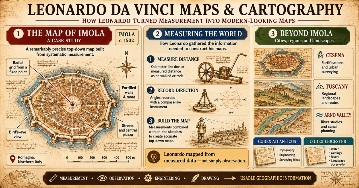
Leonardo's most famous surviving map depicts Imola, a small fortified town in the Romagna region of Italy. Created around 1502 while Leonardo worked as a military engineer for Cesare Borgia, the Leonardo da Vinci map of Imola shows the town's walls, streets, moat, and central piazza with astonishing precision.
It reads almost like a modern architectural plan, centuries before that kind of drawing became common practice. The map uses a radial grid overlaid on the town's outline, letting Leonardo calculate distances and directions from a single fixed point, an idea that mirrors how modern mapping grids still work today.
If you're wondering exactly where Imola is, it sits in northern Italy, not far from Bologna, in a region Leonardo crossed while surveying fortifications during Borgia's campaigns. The town's compact, walled layout made it an ideal test case for the kind of precise, top-down mapping Leonardo wanted to prove was possible.
Measuring the World with an Odometer
To achieve this level of accuracy, Leonardo used surveying instruments, including a device resembling an odometer to measure distance as he walked or rode through town. He recorded angles with a compass-like tool and combined these measurements with careful on-site sketching.
The result is a map built from real data, not estimation, an approach far closer to modern surveying than anything typical of the period. Leonardo even sketched designs for improved measuring devices in his notebooks, treating cartographic tools as inventions worth refining in their own right.
From the Codex Atlanticus to the Codex Leicester
Leonardo's mapping notes and drawings appear scattered across several notebooks rather than collected in one place.
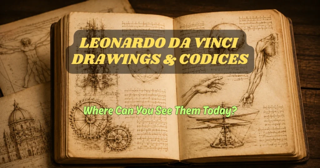
The Leonardo da Vinci Codex Atlanticus, the largest collection of his papers, contains numerous topographical sketches and engineering notes related to his cartographic work, as well as designs for weapons, flying machines, and hydraulic systems.
The Leonardo da Vinci Codex Leicester, meanwhile, focuses more on water, geology, and river movement, subjects closely linked to how Leonardo understood landscapes while mapping them. He studied erosion, sediment, and flow patterns with the same intensity he brought to measuring city walls.
Together, these pages reveal a mind constantly cross-referencing art, science, and geography, never treating any one subject as separate from the others.
Beyond Imola: Tuscany, Cesena, and the Arno Valley
Imola wasn't Leonardo's only mapping project, just his most complete one. He also produced studies of Cesena and sketched broader regional maps of Tuscany, including plans connected to a proposed canal that would have rerouted part of the Arno River near Florence.
These regional maps are less polished than the Imola drawing, more of a working diagram than a finished document, but they show the same instinct: to reduce a complicated landscape into something that can be measured, planned, and acted on.
Some pages even use simple color coding, with blue for rivers and a warmer tone for fortified walls, an early version of the map legends still used today.
If you want to see how mapmaking connects to the rest of Leonardo's engineering work, a walking route through Milan's Leonardo-related sites, like this Leonardo da Vinci-themed exploration of Milan, links several of these locations together in a single afternoon.
Where to See Leonardo da Vinci Maps Today
Many of Leonardo's original mapping drawings survive today, scattered across archives and collections in Europe rather than gathered in one museum. That's partly a matter of history: his notebooks were split, sold, and recombined by different collectors over the centuries, so no single institution holds everything he ever drew.
Seeing even a handful of pages in person, even briefly, gives a much clearer sense of scale and detail than any photograph or textbook reproduction can.
The Codex Atlanticus in Milan
The da Vinci Codex Atlanticus is held at the Biblioteca Ambrosiana in Milan, a library founded in the early seventeenth century specifically to preserve manuscripts like this one.
While the entire twelve-volume manuscript isn't always on public display, selected pages rotate through exhibitions, giving visitors a chance to see Leonardo's cartographic sketches alongside his engineering studies in the same room.
Royal and Private Collections
Some of Leonardo's map-related drawings are held in the Royal Collection at Windsor Castle in England, alongside many of his anatomical and scientific studies. This collection came together centuries after Leonardo's death, as sheets from his notebooks were bought, traded, and eventually consolidated under royal ownership.
These Leonardo drawings rarely travel, so exhibitions that include them are considered rare opportunities for enthusiasts and researchers who want to see the originals rather than facsimiles, and tickets for special showings tend to sell out well in advance.
Digital Archives Anyone Can Explore
For anyone who can't travel to see the originals, high-resolution digitized versions of the da Vinci codex collections are available through several museum and university archives.
These digital resources let you zoom into details that would be nearly invisible in person, from tiny measurement notes in the margins to faint pencil corrections Leonardo made as he refined his calculations.
Some archives even offer side-by-side transcriptions of Leonardo's famous mirror-written notes, turning them into readable text so you can follow his reasoning line by line instead of just admiring the drawing.
Exploring Leonardo da Vinci in Milan
Milan is one of the best starting points for anyone tracing Leonardo's cartographic and engineering legacy, since the city houses the Codex Atlanticus and several sites associated with his years working for Ludovico Sforza. From here, it's easy to build a wider itinerary around his life and work, whether you're staying local or planning a longer trip through Milan.
Leonardo's influence stretches across Italy and beyond. In Florence, you can trace his early training and youth. Venice holds connections to his engineering consultations on canal and defense systems.
Rome preserves traces of his final years in Italy, and Paris is home to the Louvre, where several of his most famous works are displayed, not far from his final resting place near the Château d'Amboise.
Each city adds a different layer to the same story, and together they turn Leonardo's maps from an isolated curiosity into a single thread in a much larger life spent moving among courts, patrons, and problems worth solving.
Experience Leonardo da Vinci's Cartography in Person
Reading about Leonardo da Vinci maps is one thing. Standing in front of the actual pages, or walking through a city he once mapped by hand, is another experience entirely.
The Biblioteca Ambrosiana in Milan remains the most direct way to connect with this side of his work, as it houses the Codex Atlanticus, along with exhibits that explain his surveying methods and the tools he used to take measurements.
Visitors typically spend an hour or two moving through the collection, pausing at cases showing his mechanical sketches, notes on water movement, and cartographic studies side by side. Seeing the density of Leonardo's notebooks in person, page after page of tightly packed observations, tends to change how people think about his more famous paintings.
The maps make his obsession with precision impossible to ignore, and they show a working process that most gallery visits never get close to. It's one thing to admire a finished painting; it's another to watch, page by page, how a single idea, like an accurate town plan, was tested, corrected, and refined over months of fieldwork.
For travelers who want context before stepping into the archive, a guided walk through Milan's Leonardo-related sites can connect these pages to the city itself, tying the codex directly to the streets, buildings, and canals he once studied. It's a way of turning a static document into something you can physically retrace.
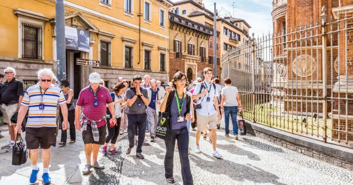
Walk in Leonardo’s Footsteps in Milan
Explore Leonardo’s Milan and discover the engineering ideas and notebooks behind his work
Explore Leonardo’s MilanLeonardo da Vinci Walking Experience, Milan
A guided walk connecting Leonardo's engineering and cartographic work to the streets of Milan.
- Visits sites tied to Leonardo's years working for Ludovico Sforza
- Context on his engineering notebooks, including the Codex Atlanticus
- Small-group format led by a local guide
Many visitors note that the added context makes the archive itself easier to appreciate. View This Experience
Many visitors find that having a knowledgeable guide nearby makes Leonardo's more technical work, like his maps, far easier to appreciate. Booking ahead is worth considering, since access to some archive exhibits is limited and popular time slots fill quickly.
Final Thoughts
This post was all about Leonardo da Vinci's maps, from the surveying techniques hidden in the Imola drawing to the notebooks that still reflect his cartographic thinking today.
Leonardo's genius wasn't confined to painting. His mapping work shows the same mind that painted the Mona Lisa treating an entire town as a puzzle to measure, walk, and record with total precision.
The Renaissance produced few figures who moved this fluidly between art and science, and Leonardo's maps are proof of exactly how far that fluidity could go. Seeing these pages in person, whether in Milan, Windsor, or through a digital archive, adds a dimension to his legacy that's easy to miss in reproductions.
If his paintings show what Leonardo imagined, his maps show how precisely he saw the world in front of him, and that combination is still rare enough to be worth crossing a continent to see.
Related Post You May Like

Disclosure: This page may contain affiliate links. If you book through them, we may earn a small commission at no extra cost to you. Learn more.
Free Leonardo Milan Travel Guide
Plan Your Leonardo Trip in Milan
A premium mini guidebook for smarter Milan planning, including the best ticket strategy, Leonardo map, and practical visitor advice.
Get the Free Guide
Download the guide and receive practical Milan planning tips by email.
Download the Free Guide >> Leonardo Bianchi is the founder of Leonardo da Vinci Inventions & Experiences, a cultural travel guide helping visitors explore Leonardo da Vinci’s art, inventions, and legacy across Italy and Paris.